Lanton Quarry
Strip, Map and Sample
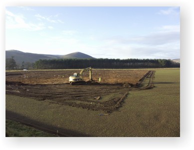
A view across Lanton Quarry during the 'strip' phase of the excavation |
Strip, map and sample is a method of excavation used by archaeologists that allows large areas of land to be investigated. It also allows relationships between features and finds to be established so that a better understanding of the site can be gained. A site such as Lanton Quarry that has such a large area is an ideal location for a strip, map and sample to be carried out. The test pit had already confirmed the presence of archaeology surviving in the gravel beneath the ploughsoil and so the next stage was for the ploughsoil to be removed and this is called the 'strip'.
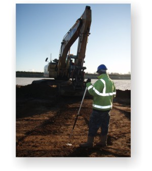
The plough soil is carefully stripped away using a mechanical excavator. The large quantity of ploughsoil produced is loaded into dump trucks and is then taken to the side of the quarry where it is mounded up into soil banks known as 'bunds'. This ploughsoil is stored there during the life of the quarry before being spread back over the quarry site as part of the restoration programme when it is returned to grassland or agricultural production.
Once all of the ploughsoil has been stripped, the surface is cleaned back manually by archaeologists and archaeological features are ‘mapped’. This involves marking the features, photographing them and then drawing them. The drawings are compiled on to a site plan so that all the remains can be looked at in relation to each other and any patterns identified.
Decisions are then made as to which features to excavate and how much. Positioning where to excavate a feature is an important archaeological skill as this determine how much information is gained. This part of the excavation is the 'sample' process. The features are hand-excavated, redrawn, and photographed. The fill of each feature is sieved to collect all artefacts and charred wood and plant remains are also kept for radiocarbon dating.
Record sheets are also filled out for each feature.
 |
Lanton Quarry during the strip, map and sample with the Cheviot Hills in the background and archaeological features marked by the wooden pegs |
The post-excavation stage of an excavation involves digitising illustrations and writing the report. Any samples and finds, such as pottery and flint, are analysed by specialists. Once the specialists have written their reports, the whole document is put together and prepared for publication.
An excavation can often be very hard work as it involves physical labour and can take place in the summer or winter months. It also provides a great opportunity to involve young people, students and the local community. Lanton Quarry has provided much public involvement so far but if you want to get involved in future archaeological work on the site click here.
The strip, map and sample of Lanton Quarry happened in two stages. Phase 1 was carried out in 2006 on 9.5ha of the site and phase 2 was carried out in 2008/2009 across 1.5ha. The excavation of each area used the methods described above and each revealed significant archaeological remains. For more information about what we found across the Lanton Quarry site please use the links in the 'Archaeological Discoveries' section at the left hand side of this page.

