The Till-Tweed Geoarchaeology Project
 |
 |
The Till-Tweed Project has been designed to enhance understanding of a large river valley through archaeological and palaeoenvironmental analysis. As the name suggests, the Till-Tweed Project is based around the reaches of the two rivers, the Till and the Tweed in north Northumberland. The project has been funded through the Aggregate Levy Sustainability Fund distributed by English Heritage. It is a collaboration between ARS Ltd and Newcastle University.
The project contains four fieldwork strands which have been combined to produce an in-depth landscape history. These include:
- Geoarchaeological evaluation including the use of Lidar data to provide accurate mapping of the valley, as well as assist field survey and sediment coring.
- Transcription of aerial photographic evidence for accurate mapping of upstanding archaeology, and buried sites showing as crop and soil marks.
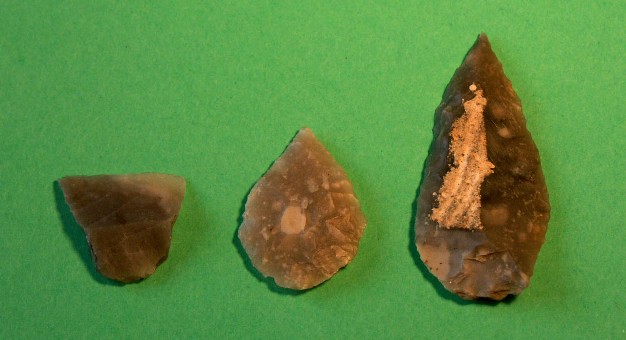
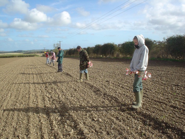
- Fieldwalking and test-pitting to obtain flint tools so as to characterise Stone-Age activity across the study area.
- Public outreach and education work which has already included fieldwork participation and training for schools and colleges, and the production of popular books, information panels and guided walks for visitors and residents.
For more information see:
• Passmore, D., C. Waddington and T. van der Schriek. (in prep). Geoarchaeology and archaeological landscapes in the River Till and Lower Tweed valleys, northern England. Antiquity
• Waddington, C. and Passmore, D. (forthcoming). Slope Process and Artifact Scatters: a Framework for Characterization and Analysis. Geoarchaeology